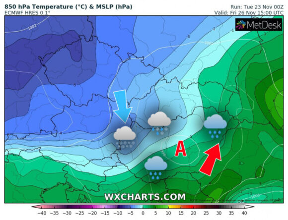
Mediterranean cyclones will bring changeable, rainy weather from the second half of the week – the Időkép reported.
Based on the latest model runs, it increasingly appears that on Friday, the western, northwestern part of the country will immediately be in the backward flow system of the first Mediterranean cyclone to migrate.
This means that cold, frosty air masses come to these landscapes from the north, which can overlap with the rainfall, resulting in a change of state, so on Friday there is a good chance of snowfall in the west and northwest.
Significant snow cover is more likely to occur in higher landscapes, such as the foothills of the Alps and the Bakony.
debreceninap.hu


