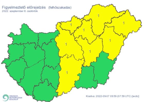
On Thursday, a cold front will arrive over the Carpathian Basin, and the warm, moist conveyor belt that will form in front of it will bring showers, thunderstorms, and sometimes large amounts of precipitation in many places.
According to the forecast of the National Meteorological Service, there is a greater chance of outbreaks of showers in the area of the Northern Central Mountains from late morning, and then rain, showers, and thunderstorms are expected in more and more places along the front of the cold front coming from the northwest, which may be accompanied by mainly intense precipitation. The precipitation zone moves to the east and southeast in the evening.
The animation of Időkép shows how the precipitation zone will arrive and roll over us:
Thunderstorms associated with the front may be accompanied primarily by downpours (locally > 20-30 mm, more likely in the Northern Central Mountains and the northern part of the Great Plain), and in addition by stormy wind gusts (~60-90 km/h, in some places >90 km/h) and small ice may also occur in their environment. From late evening, stabilization will begin from the northwest.
The highest daytime temperature is expected to be between 27 and 33 degrees.
A first-degree danger signal will be in effect for the Hajdú-Bihar county on Thursday due to both the threat of thunderstorms and downpours.
debreceninap.hu


