Multi- and hyperspectral remote sensing, photogrammetry, laser scanning, geovisualization – students who choose the new master’s degree in geoinformatics at the Faculty of Science and Technology of the University of Debrecen can learn about the most modern earth science technologies and procedures.
The fact that it is already possible to apply for this year’s admission procedure, and the master’s degree in geoinformatics at the faculty will start in September, can give a new impetus to the GIS training and research at the Faculty of Science and Technology of the University of Debrecen.
GIS is a young but rapidly developing field of earth sciences, occupying an important place in the training and research portfolio of the Faculty of Science and Technology. The geographer was our first science major, which also started in a dual form of training. The fact that earth science is a field of science that has a direct technological application, due to which companies welcome our graduates with open arms, plays a role in this. That is why it was especially important for our faculty to be able to start a master’s degree in geoinformatics.
– Ferenc Kun, the dean of the Faculty of Science and Technology, told about the new training.
The faculty leader added that there was significant demand for participants in geography training as well, and they are confident that the new degree will surpass this as well, as many corporate partners have already expressed interest in the new training.
Professor Szilárd Szabó, the director of the Institute of Earth Sciences, who started the program, said that in the new, independent master’s program they can deal with the special knowledge of data collection, data analysis, and remote sensing, as well as the related economic, legal and human knowledge.
Basic knowledge of natural sciences: geographical research methods, applied geomathematics, modeling, simulation, and geostatistics, special skills: scientific data mining, spatial data analysis, data collection techniques, multispectral remote sensing, hyperspectral remote sensing, applied space sensing, photogrammetry Master’s students can study agricultural informatics, CAD systems, geovisualization, and modeling.
– listed Szilárd Szabó.
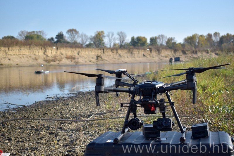
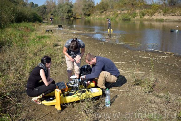
The director of the institute added that prospective professionals can master all modern and traditional methods of data collection, from satellite positioning systems (GPS / GNSS) to ground and airborne laser scanning to aerial photography and satellite remote sensing. During the training, special attention will be paid to unmanned aerial vehicles as one of the most effective data collection tools today, from flight planning to photography to photogrammetric processing; and teach the analysis of 3D point clouds of laser-scanned data using ground and aerial techniques and the possibilities of extracting objects, such as reconstructing buildings in a scale model.
“The goal is to train professionals who can see the full range of spatial data from data collection to target-specific visualization.”
– the professor said. Szilárd Szabó also mentioned that the Institute of Earth Sciences has two well-equipped computer laboratories, 4 RTK GNSS (approx. 3-4 cm accuracy), 5 UAVs (2 high-resolution visible ranges, 4 multispectral and 1 thermal camera), 2 space scanners, and one A geodetic measuring station awaits applicants for the geoinformatics department. Students can gain practical experience through internships at many of the faculty’s industry partners.
The master’s degree in geoinformatics can be continued by the student who specializes in geoinformatics in the field of geography, specialization in cartography and geoinformatics in the bachelor’s degree in geography, and in geoinformatics in geology graduated in one of the undergraduate courses in agricultural and business digitization.
In addition, other specializations in the field of natural sciences and the bachelor’s degree in environmental sciences, the bachelor’s degree in environmental sciences, the bachelor’s degree in surveying and land management engineering in the field of agriculture, and the technical and environmental engineering courses in the field of engineering the bachelor’s degree program in technical earth sciences, the bachelor’s degree program in informatics from the field of informatics.
More information about the training is on the website of the Institute of Earth Sciences of the Faculty of Science and Technology.


