


Due to the risk of severe thunderstorms, HungaroMet Zrt. issued a second-level (orange) alert on Tuesday afternoon for certain districts in Békés, Hajdú-Bihar, and Szabolcs-Szatmár-Bereg counties.
Public transport suspended
Because of the stormy weather, all bus, trolleybus, and tram services have been suspended. Public transportation will resume on all lines as soon as the weather allows.
“We ask for passengers’ understanding and patience,”
– announced DKV.
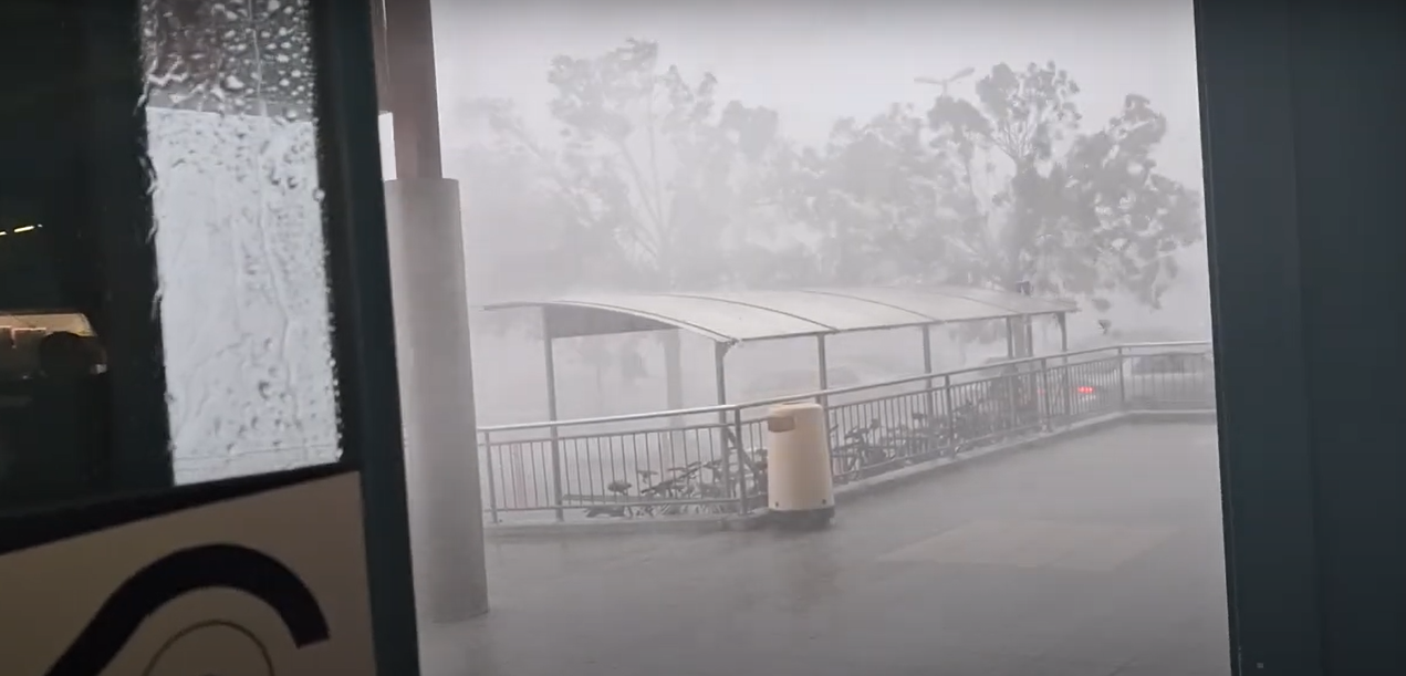
The storm reached Debrecen shortly after 2 p.m. (see top photo).
A brutal downpour hit the area near Malompark:
According to the warning sent to MTI, stronger thunderstorms are expected in the affected districts in the coming hours, with not only lightning but also wind and hail posing risks.
A second-level warning remains in effect until midnight Tuesday due to the risk of severe thunderstorms in the counties of Baranya, Bács-Kiskun, Békés, Borsod-Abaúj-Zemplén, Csongrád-Csanád, Hajdú-Bihar, Jász-Nagykun-Szolnok, Somogy, Szabolcs-Szatmár-Bereg, and Tolna. In the rest of the country, a first-level (yellow) alert is in place.
Forecasts suggest that the thunderstorm system will continue moving northeast, typically accompanied by heavy rain, strong wind gusts, and small-sized hail. From late morning onwards, intense thunderstorms may form in several waves from the south and southwest, bringing stormy winds of 60–90 km/h, hail, and localized flash floods.
From midday, the likelihood of severe thunderstorms will especially increase in the southern parts of the country and in the Tiszántúl region. Conditions are also favorable for thunderstorm cells to organize into a system, particularly in the Great Plain, where damaging wind gusts over a larger area cannot be ruled out. Due to the passing cold front, the northwest may also experience stormy wind gusts in the afternoon.
They noted that the exact timing and location of the potential thunderstorm system remain highly uncertain. Attention was drawn to the possibility that, depending on weather developments, a red alert might be issued for the eastern and southeastern border areas due to destructive wind gusts accompanying severe thunderstorms.
By the evening, thunderstorm activity will gradually subside across most of the country, although in the northern and northeastern regions, lightning-accompanied showers may still occur during the night.
The National Directorate General for Disaster Management advises everyone to monitor weather forecasts and take necessary safety precautions. Before the stormy winds arrive, it’s advisable to secure or move indoors any objects that could be blown away by the wind and disconnect power in areas that may be flooded.
They ask that in areas under thunderstorm warnings, people stay especially alert near trees, tree-lined roads, and scaffolding, and avoid parking under power lines or trees. Pedestrians should also be cautious when walking near tree-lined roads.
Those on the road are also urged to be cautious; both driving and walking through deep water can be dangerous, as flash floods pose a serious risk and can sweep away people and objects. They advise drivers to stop somewhere if the storm hits, or at least slow down if stopping isn’t possible.
During thunderstorms, avoid lookouts and electrical poles. Do not stand under trees or use umbrellas. If lightning strikes while you’re in the forest, find a place at least 4–5 meters away from tree trunks.
They also ask that if anyone sees a person in distress or a downed power line, they should report it by calling the emergency number 112.


